Hiking the Tulsa Levees
Forgive my overgrown hair on a windy day. It’s been quite the battle lately.
My whole life, I’ve grown up around the levees. The flagship park in Sand Springs sits between the Arkansas River and the westernmost levee in Tulsa County. I’ve spent countless weekends at the Jenks Riverwalk, where people used to drive right over the levee to exit the overcrowded shopping center during its heyday.
If you’ve ever driven 412 from Sand Springs to Tulsa, you can’t help but see the massive man-made hills that protect the community from Arkansas River floodwaters. And during the historic floods of 2019, which I covered extensively, they were the nonstop talk of the town.
The levees were all that stood between the Arkansas River and untold property damage in the heart of Sand Springs in 2019.
But one thing I’ve never done is looked at the levees as a destination in and of themselves. They’ve always just been part of the landscape, not an attraction or special feature. I started to look at them a bit differently when Charles Page High School began hosting its Case Cross Country Invitational at Case Community Park in 2018.
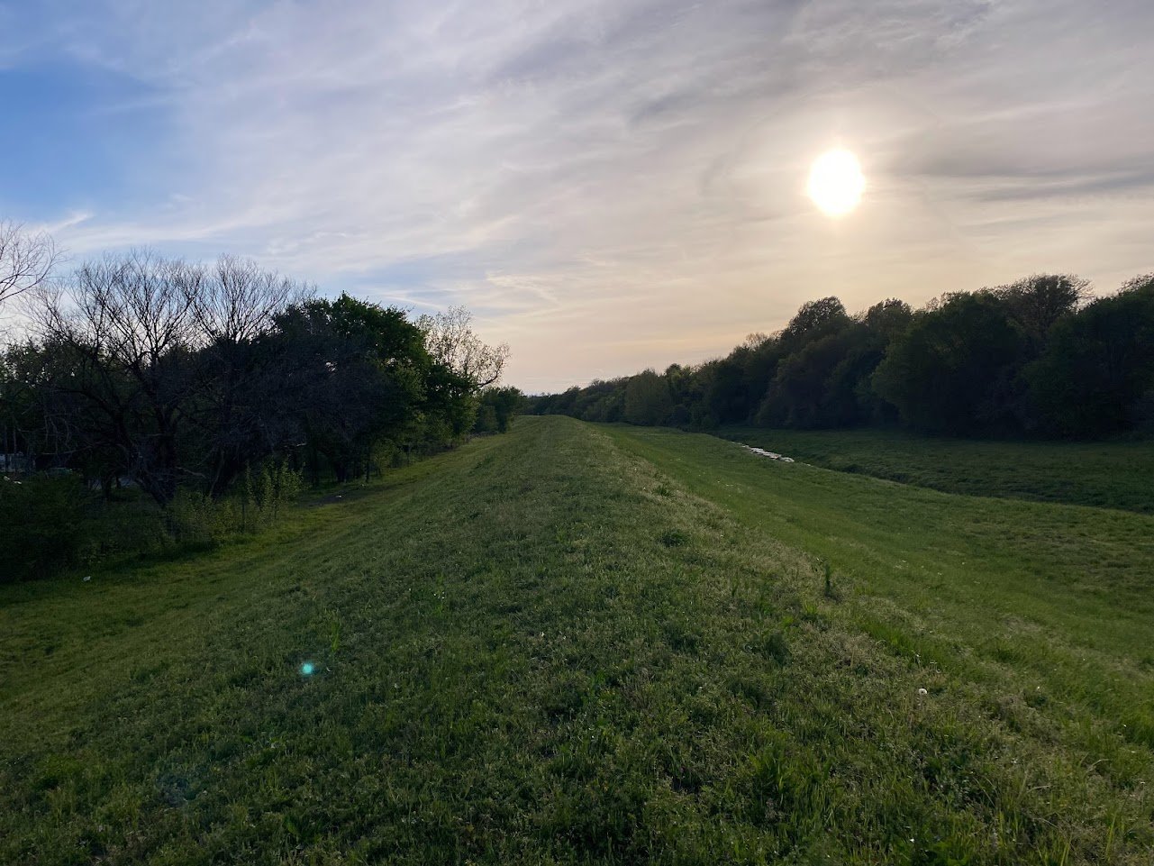
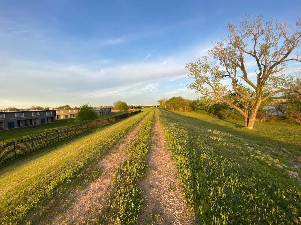
A significant portion of that 5K run is held atop the Sand Springs levee, giving participants a unique and beautiful view of the river and park. I’ve seen people jog the levees before but I’ve never considered it to be a type of hiking or exploration. Until recently, that is.
On a sunny spring day in April, I set out to jog/hike the levee from 49th West Avenue to Sand Springs. I’m quite out of shape, and spent significantly more time walking than I did running, and it quickly turned from an exercise in cardio to a fun new opportunity for urban exploration.
The Northwest Tulsa Levees


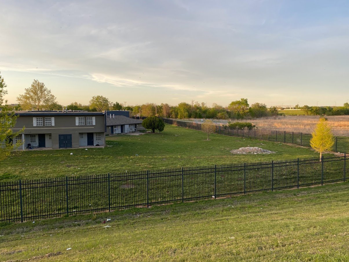
My goal was to travel the levee from my neighborhood to Sand Springs, where I would meet my fiancée at our gym. There are two levees that run that direction. One protects the west side from the Arkansas River to its south, and the other protects the hood from Harlow Creek to the north.
I took the northern levee that runs along Highway 412 and made quick work of the first mile or so to 65th West Avenue. I was the immediate concern of every dog whose backyard abuts the levee but fortunately they all appeared to be secure in their premises. It definitely felt far safer than taking Katy Trail in the opposite direction, where many of the fences were barely restraining aggressive canines. There were also, surprisingly, zero signs of homeless people along this route.
If you’re looking for a good camelback for your next hiking adventure, I personally recommend the ECEEN hydration backpack with a solar panel. I got this camelback in 2016 to use for playing Pokémon Go and it has served me very well over the years!
“Abandoned Oklahoma” or your standard house on the west side?
As a lover of well-manicured lawns, I had to stop and admire this gem near 65th.
It was neat walking underneath the new Gilcrease Expressway extension that’s currently under construction and seeing how close it is to finished. A lot of people on the west side seem to think it’s going to raise their property value and lead to renewed development on that side of town but I fail to see the logic. We already have 412 and that hasn’t helped. There’s plenty of highway in Sapulpa and southwest Tulsa and those areas are in the same shape as ours. But hopefully I’m wrong.


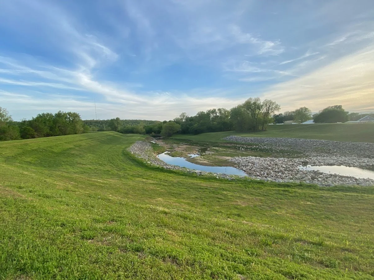
After crossing 65th, you find about a 20-acre area of land that I would love to see developed into a disc golf park one day. Bigheart Creek and Harlow Creek converge in a beautiful area that can never really be developed due how flood-prone it is.
This area is designed to flood, making it useless for commercial or residential development. In 2019, nearby residents could be seen fishing and kayaking on 11th Street.
The River Parks Authority owns about 15 acres of this beautiful landscape, which features large, mature trees, lots of elevation change, and a creek that’s always running. North of 11th Street, the Board of County Commissioners owns another four acres with nothing on it but an oil well.
This area is perfect for a disc golf course since they’re affordable, low-maintenance, and can easily survive a flood so long as no heavy debris collides with the baskets. The west side is a severely under-served community when it comes to parks in general, and disc golf in particular. The only disc golf course in northwest Tulsa is an atrocious 8-hole course at Ziegler Park. Those baskets could easily be relocated to this area so the terrible Ziegler layout would no longer interfere with other park-goers.
The 65th West Avenue Levees


Getting back on track after my disc golf rant…
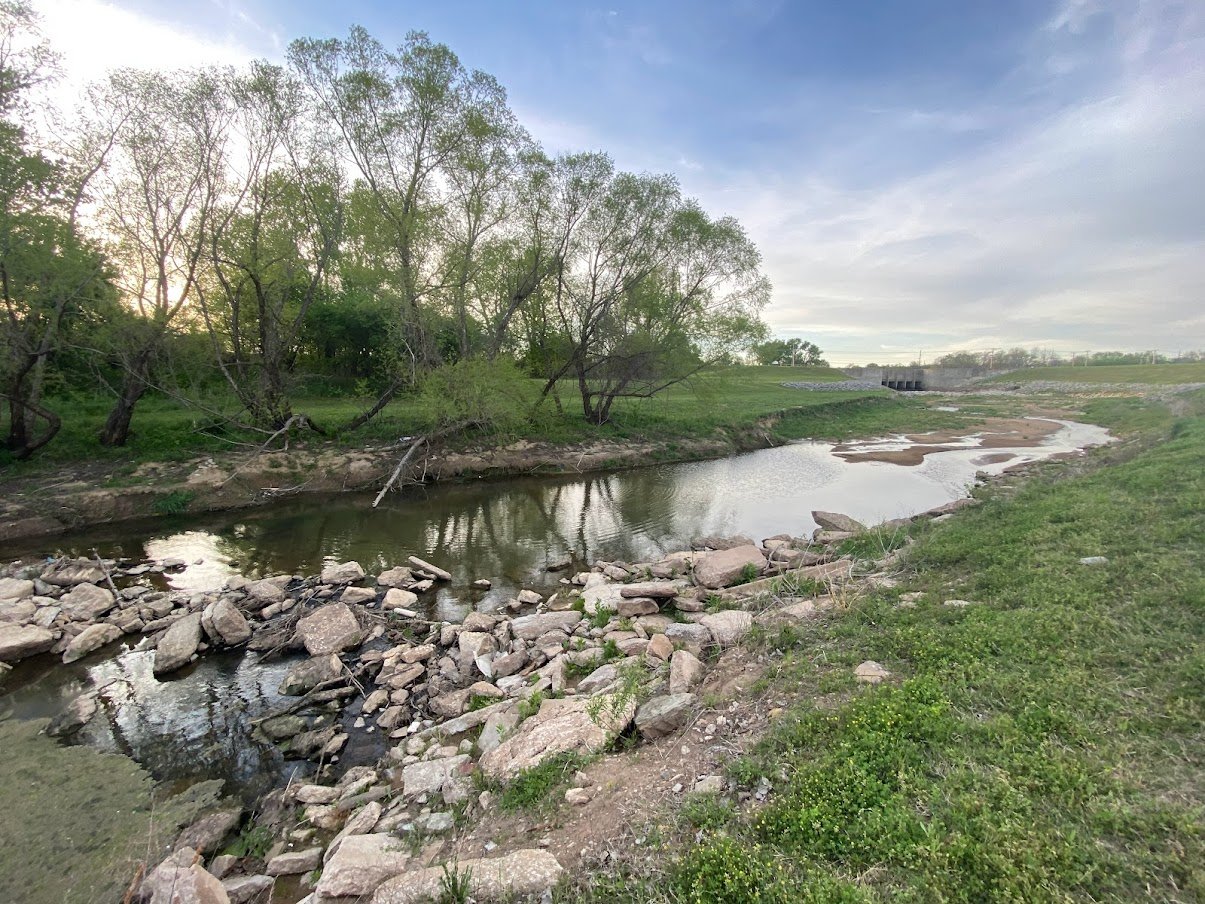
I crossed Charles Page Boulevard near 65th West Avenue and instead of continuing to Sand Springs, I instead doubled back along the southernmost levee heading east. The area along Bigheart Creek is beautiful and feels very secluded considering how close it is to civilization.
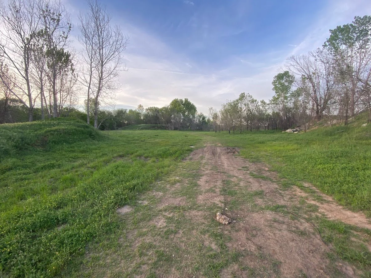
One thing I noticed behind the strip mall on Page Blvd. was what appears to be an abandoned mobile home park. Empty concrete slabs dotting the sides of two overgrown streets are all that remains, and I wonder how long ago it closed, and why its residents moved elsewhere.


As Bigheart Creek meets the Arkansas and the levee turns back to the east, there’s an apparently popular river access point with evidence of fishing lines and ATVs, as well as stacks of sandbags abandoned since the 2019 flood.


When I realized I was coming up on Sandy Park, I admit I got a little bit nervous. The housing project doesn’t exactly having a sterling reputation, but I quickly realized it wasn’t much different than my own nearby neighborhood. Poor, trashy, but nothing particularly dangerous. There was debris everywhere, but there was also the sound of children playing and evidence of happy families and typical childhood shenanigans. I spotted a section of fencing that had been forced out to allow kids access to the levee, woods, and river - and I’m betting a lot of great memories have been made by children escaping through that hole.


Not far past Sandy Park I once again passed beneath the new Gilcrease turnpike extension, and just past there is where my journey ended.
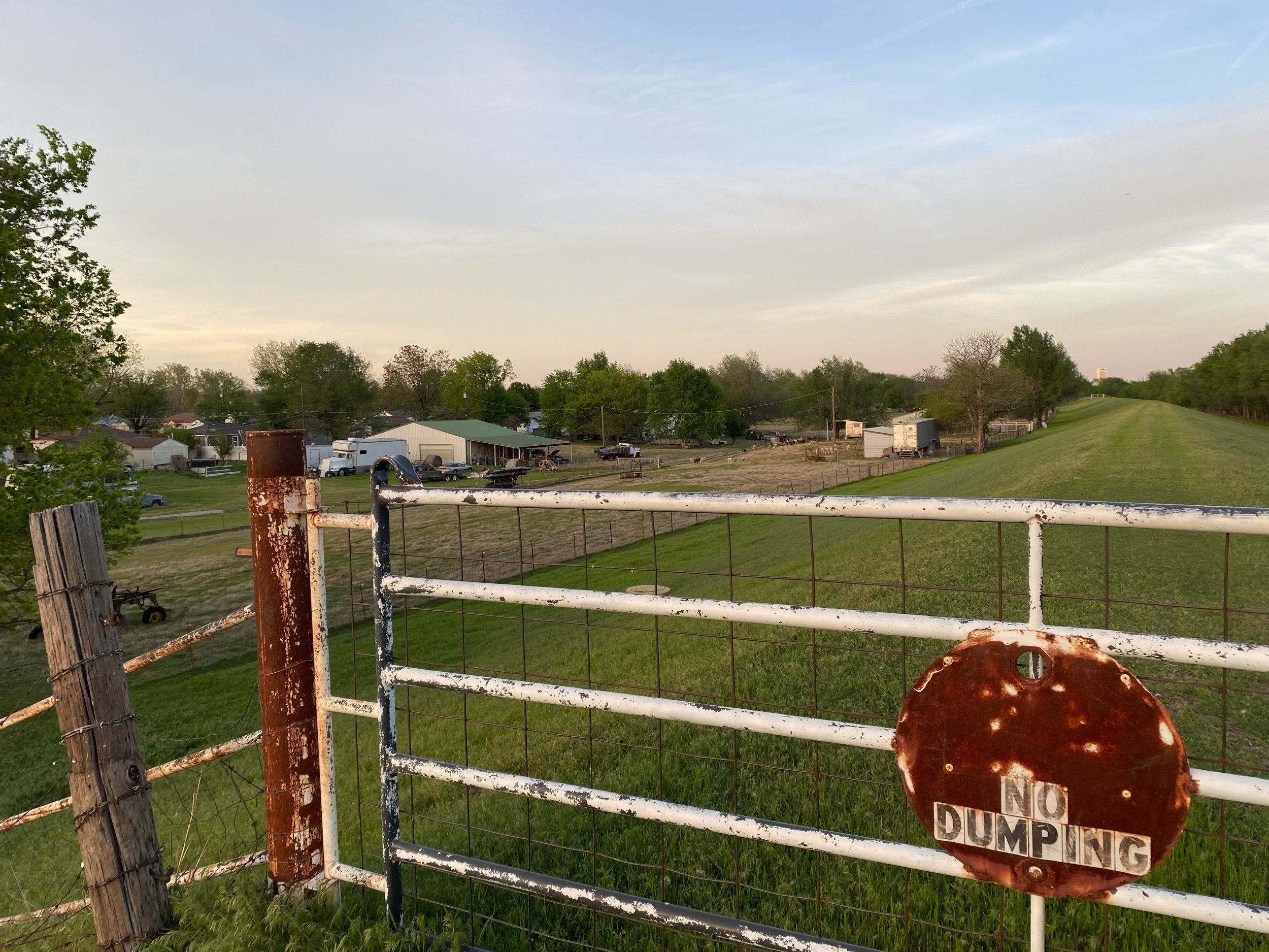
The hike ended at 57th West Avenue, where the levee was suddenly gated. Of course, there are many gates along the levee to prevent unauthorized motor vehicle access. But this one had extensive fencing on either side of the gate, and an electric wire that traveled all the way down the levee to the goat farm on the north, and the river on the south.
It was my impression that the levees were Army Corps land and thus open to the public where not otherwise restricted, but I suppose it’s possible this goat farm has some form of lease with the Corps. I detoured down to the neighborhoods and walked home from there, and will return another day to finish my exploration.


What was intended to be a quick jog has now inspired me to explore the entire levee system wherever possible, so I’ll keep you all posted and update this post as I go!