Roaring River State Park, Missouri
Me on the far right with my cousins Jon (left) and Cameron (center).
When you’re young, everything seems bigger. More magical. But when you grow up, the world tends to lose its spark. The same places that once inspired awe and wonder become just another inconvenience. Crowds distract you from the sights, traffic distracts you from the skylines, a never-ending chore list distracts you from your once-vivid daydreams. Magical Kingdoms become overpriced tourist traps.
But not everywhere. There are some places that transport you right back through time to a world you thought was long lost.
Roaring River is one of those places.
The river valley stays cool and the nights are chilly. Every morning you’re awakened by a deafening symphony of bird song. Everything is covered in morning dew and the smell of campfire smoke permeates the air. It’s a safe place where kids run wild and belongings are left unattended.
Growing up, we visited Roaring River State Park just about every year. It feels like home, and I know those campgrounds as well as I know my own backyard. I recently visited with my mom, wife, brother, sister-in-law, and nephew for the first time since 2015 and it was exactly as I remembered it. Every piece of the magic was intact and I felt like a kid again almost immediately.
Charity and I took a goodbye selfie from campground 3 on our way out.
Camping in a Time Capsule
There are a million things that make Roaring River special, but first and foremost is how incredibly safe it feels. When I was a kid my parents would turn me loose in that park. I’d ride all over the place on my bike or scooter with little to no supervision. My cousins and I would trek up and down the river, visit the Ozark Chinquapin Nature Center, hike the trails, and not see our parents for hours.
Twenty years later and I still see the same situation playing out with other families. Roaring River just feels safe, like a setting from a 1960s family sitcom where nothing bad ever happens, there’s no crime, and the kids are free to create memories unimpeded. We left our campsite unattended for hours at a time with all kinds of equipment sitting out in plain view where anyone walking back from the restrooms could easily swipe it. But it remains a safe and special place. I can’t count how many kids I saw running loose, lost in the magic of youth, without a care in the world.

The Ozark Chinquapin Nature Center features educational materials about the history of the park, as well as live animals like snakes and turtles.
Perfect for Beginners
The Roaring River campgrounds are exceptionally maintained and super convenient for glampers and first-timers who aren’t ready for roughing-it scenarios. Each of the three campgrounds has paved roads throughout with parking spots large enough for two cars or a camper, picnic tables, fire pits, lantern/trash posts, plenty of space for 2-3 tents or shade structures, and many of them have electrical and water hookups as well.
I’ve never stayed in Campground 1 that I can remember. My family typically stayed in Campground 3 when I was a kid, though we stayed in Campground 2 this most recent Memorial Day weekend. I really liked Campground 2 but unfortunately we ended up with the last spot available, immediately next to the restroom/shower-house and the main road, which meant not only did we have road noise all night long but we also had headlights shinning in our tent all night as people who were deeper into the grounds drove to the restroom late at night.
Charity plays cornhole with my nephew, Tyler, at Campground 2.
It was still quiet and peaceful throughout the day, but it made for a rough time sleeping. Next time we go we’ll book our spots earlier so we can get a nice secluded space.
The restrooms are all well-maintained, there are convenient dumpsters on-site, and with the electrical/water hookup options, this really is the perfect campground for anyone new to camping. Campgrounds 2 and 3 run right along the river, making them the most convenient for fishermen and nature lovers.
There’s also a convenient new camp store within walking distance where you can purchase your daily trout tags, as well as firewood, food, coffee, and any other camping supplies you forgot to pack.
Roaring River State Park Maps
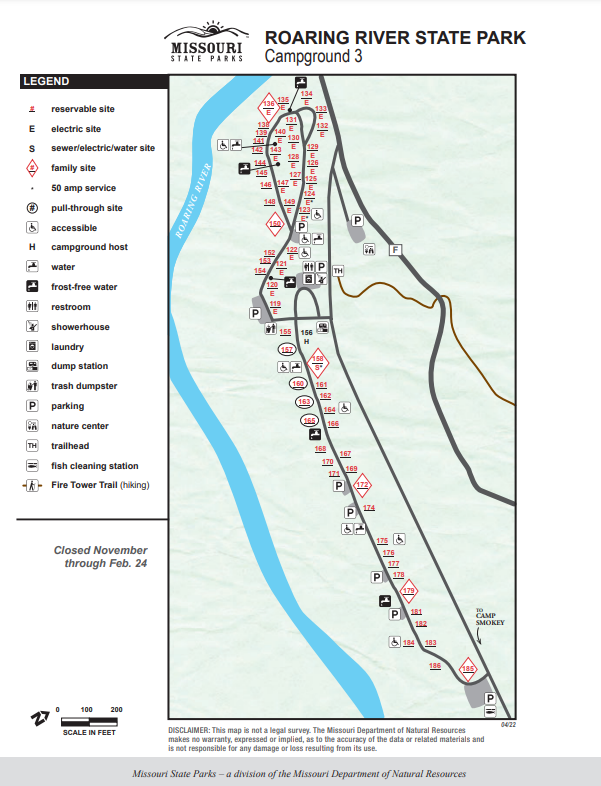


The Caverns
A small waterfall and underwater cave system form the source of the Roaring River.
Located just outside the southwestern portion of the Mark Twain National Forest, the 15-mile Roaring River emerges mysteriously from a cave system deep in the Ozark Mountains. In 2021 a team of elite divers certified Roaring River as the deepest-known spring in the United States with a 472-foot dive.
When I was growing up Roaring River was only certified to 225 feet after dives in 1979 and 1999 ended with a restriction point that traditional scuba gear couldn’t maneuver around. With modern equipment they were able to bypass that restriction and reach new depths. The mission: a series of monthly dives to study the cave ecosystem, reach new depths, and film a documentary that will be watchable in the nature center. But it came at a cost.
In October of 2022, diver Eric Hahn died from an incorrect mixture of oxygen and nitrogen in his tank - causing an oxygen seizure. The 27-year-old had previously been interviewed by Michele Skalicky with KSMU.
Past the caves, there’s a large pool at the start of Roaring River that stays a beautiful blue green and is stocked with massive trout and carp.
"You know, fewer people have gone through this one location than have even been on the moon," Hahn said, referring to the restriction point.
Some people live so large. Hopefully his legacy lives on and inspires a new generation of explorers and researchers.
Lead diver Mike Young has released a series of short videos documenting the dives thus far and I highly recommend following his YouTube channel.
The KISS Rebreathers applied for a renewed permit in 2023 but it was denied. According to an official with the Missouri State Parks, “the permit did not provide sufficient information detailing the purpose or explicit need for the continuation of this project as scientific research, nor does it provide any substantive details concerning updated methods, safety protocols or emergency response planning to provide assurances to address any past negative safety outcomes.”
I’m not surprised. While I think expeditions like the KISS team’s are important, there’s a lot that can go wrong - obviously.
“We agree the work to date has scientific and interpretive benefits but do not agree that the unspecified, additional work outweighs the significant safety concerns of personnel revealed in past dives,” said the division information officer I spoke with.
Hopefully either KISS, or some other team, can put together a comprehensive safety strategy in the future that will allow for new discovery with more safeguards in place.
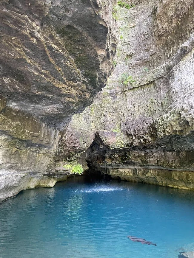
Roaring River Fish Hatchery
The 0.4-mile out-and-back Deer Leap Trail provides a breathtaking panoramic view of the hatchery. On high-visibility days you can even see the remnants of an historic 19th century mill wheel under the surface.
The headwaters of Roaring River are home to more than just a cave. It’s also the site of one of Missouri’s nine fish hatcheries. Founded in 1910, the hatchery is home to 40 raceways and an incubator building.
The hatchery produces a steady supply of brown trout and rainbow trout that are used to stock the river along the campground areas throughout the fishing season of March 1st through October 31st.
Shortly after the 8:30 p.m. horn sounds to end fishing for the day, a tractor sets out from the hatchery pulling live wells filled with trout. One of my favorite childhood memories is chasing that tractor along the shores of Campground 3 and watching them fling fish by the net-full into the water. There was always a large posse of kids on bikes racing along behind the tractor, excited to get an up-close-and-personal view of the trout in the shallow waters along the shore. Of course, as kids, we would wait for the tractor to pull out of view before trying to catch (and release) them by hand while they were too stunned to swim away.

Roaring River Zone 2 fishing hole in Campground 3, as seen from the opposite bank’s Eagle’s Nest Trail.
The trout are fascinating to view at the hatchery as well. There are quarter-operated food dispensers so you can feed the fish. In the main pool there are massive lunkers who are lucky enough to live our their lives with no risk of being caught, so long as they don’t accidentally swim out through the spillway and into the main river. The raceways are stuffed full of overcrowded trout that throng like piranha in a horror film whenever you fling a handful of food.
The River

The river itself is divided into three zones. The first zone flows from the hatchery to Dry Hollow Creek and only artificial lures, soft plastic baits, and flies are permitted.
Zone Two flows from Dry Hollow to the old dam at the lower end of Campground 3. Only flies are permitted in this zone. There’s a catch-and-release area from Dry Hollow to the Highway F bridge and swimming is also allowed along Campground 2.
The sportiest of fishermen will find themselves in Zone Three, past the end of Campground 3. Zone Three is the wildest portion of the river and all forms of bait are allowed here. The river forks past the dam and creates a large island. The Fire Tower Trail follows the northern portion of the fork and there’s another swimming area downstream. Eventually Roaring River joins with Table Rock Lake near Eagle Rock.
Hiking Trails in Roaring River

The beginning of the Fire Tower Trail follows the north shore of river alongside some beautiful rock formations.
My wife and I are avid hikers and since we’re rather out of practice at fishing, we decided to leave the poles at home and spend our time on the trails. On our first full day at the park we undertook one of our most ambitious hiking days yet, ending the evening with a little over 12 miles.
Fire Tower Trail
We started our Saturday with the Fire Tower Trail, a 4.4-mile loop with several convenient access points. We walked from our spot in Campground 2 all the way to the far end of Campground 3 and entered the trail near where the river transitions to Zone 3.
The trail starts out along a powerline easement that has its own beautiful selection of wildflowers and flowing hills before dipping down along the river in Zone 3. The shaded path follows beautiful rock formations at the bank of the river for a quarter mile or so before turning up north to run the underside of Highway F.

Easily one of the most beautiful sights I’ve ever seen, this glade on the Fire Tower Trail was bursting with at least
There’s a tricky turnoff where you climb up some rocks to get out of the old riverbed and onto the highway right-of-way. If you’re following a map like AllTrails then you shouldn’t miss it, but if you’re traveling offline then you’ll want to keep your eye out because it’s easy to follow the false lead an extra 30 yards before running out of trail.
After crossing Highway F into the Roaring River Hills Wild Area, it’s a short uphill hike through the woods before you’ll arrive at a beautiful dolomite glade filled with daisies, pinkladies, larkspurs, coneflowers, and countless other wildflowers. There’s a parking area on the side of Highway F so even if you’re not a big hiker, I definitely recommend making the under-a-mile out-and-back trek from the road at the very least just to catch a glimpse of the thousands of butterflies.
More uphill woodlands await as you exit the glade. We encountered a handful of massive rockfaces as we ascended more than 500 feet. Before too long you’ll reach the eponymous fire lookout tower, constructed by the Civilian Conservation Corps in the 1930s.
My own hometown of Sand Springs purchased a similar lookout tower to erect at Keystone Ancient Forest but that project has stalled out as the available funding won’t cover the lowest renovation bid. Hopefully some day it’ll happen.
The fire tower at Roaring River has seen better years. A heavy limb has clearly collided with the guardrail on the first flight of stairs, bending it to where anyone with wide hips will struggle to round the first corner. But the steps are all still sturdy, as is the viewing platform at the top.
While the tower is neat, the view is nonexistent. The forest canopy is far too tall and you won’t see anything from the top but the nearby trees. Still makes for a good snack break spot though.
Deer Leap Trail
The Deer Leap Trail offers beautiful panoramic views of the Roaring River fish hatchery.
Another great feature of the Fire Tower trail is that it connects with the 0.4-mile Deer Leap Trail at the hatchery. What the Deer Leap Trail lacks in length it makes up for with brilliance. The steepness will challenge even active hikers but you’ll at least get to climb historic rock steps constructed by the CCC in the 1930s.
I made Charity hike the Fire Tower Trail to the hatchery instead of driving to it because I wanted her first view of it to be from the overlook instead of from the parking lot. She was grateful after the fact.
The Deer Leap Trail shifts from large rock steps to wooden platforms filled with informational signage about the history of the trail and park as well as info on local flora and fauna. The outlook is a good hundred feet high if I had to guess, though an official number is unavailable, and on high-visibility days you can even see a mid-19th century mill wheel beneath the waters of the main pool.
Eagle’s Nest Trail has a few large rockfaces but, aside from the riverside portion, it’s one of the less exciting hiking trails in Roaring River.
Eagle’s Nest Trail
After finishing off the final mile or so of the Fire Tower Trail to return to camp, we had a quick dinner before departing on the Eagle’s Nest Trail.
Eagle’s Nest is a 2.7-mile loop starting at the downstream end of Campground 2. The trail cuts into the side of the hill on the opposite side of the river from Campground 3. There’s no fishing allowed on this side of the river, giving the hikers complete privacy. Very little noise manages to survive the rippling waters and climb the hill.
I’ve never seen any eagles nesting on this trail, though you do get a nice eagle-eye view of the fishermen and other folks hanging out along the river, completely unaware they’re being watched from above.
While Eagle’s Nest is a breathtaking trail for the first portion, filled with river views, small streams, and lots of beautiful rock faces, it soon turns into a steeply graded gravel access road in full sun with no views. It pays off after a short while though, dipping back across the hills to more natural area and some neat rocky overhangs.
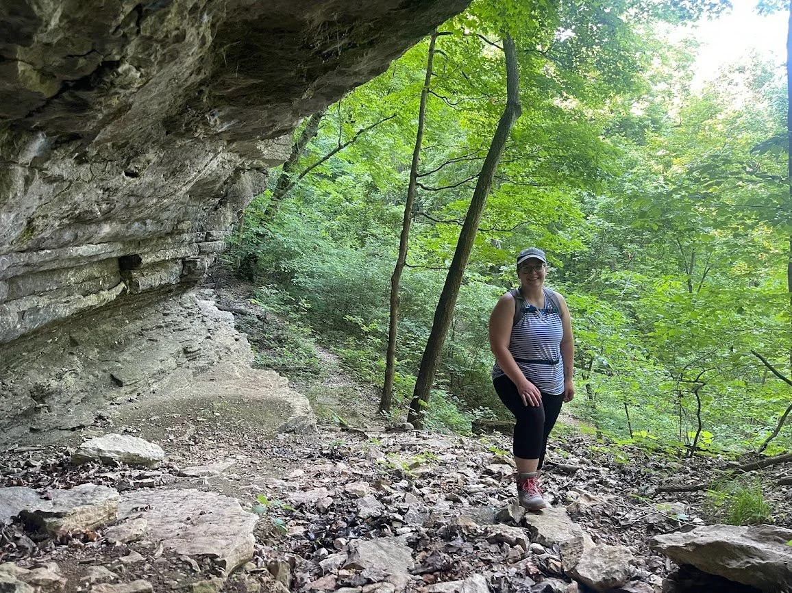
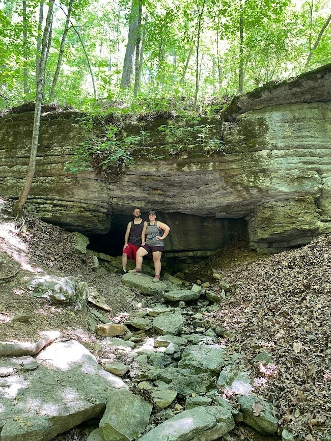
This cave went back a good 15 to 20 feet but I only went about 10 feet in for fear of snakes.
After reconnecting with the gravel road at the top of the hill you’ll pass some scattered blackberry and wildflowers on a nice downhill hike back to the same riverside trail you started on. We also saw a bunny on the way back.
Devil’s Kitchen Trail
On Sunday of our most recent trip we hiked the Devil’s Kitchen Trail after breakfast and although I still think I prefer the Fire Tower Trail, Devil’s Kitchen was a close runner-up and easily the more popular.
We passed countless other hikers on this trail, so if you’re looking for peace and tranquility, you won’t find it here for long.
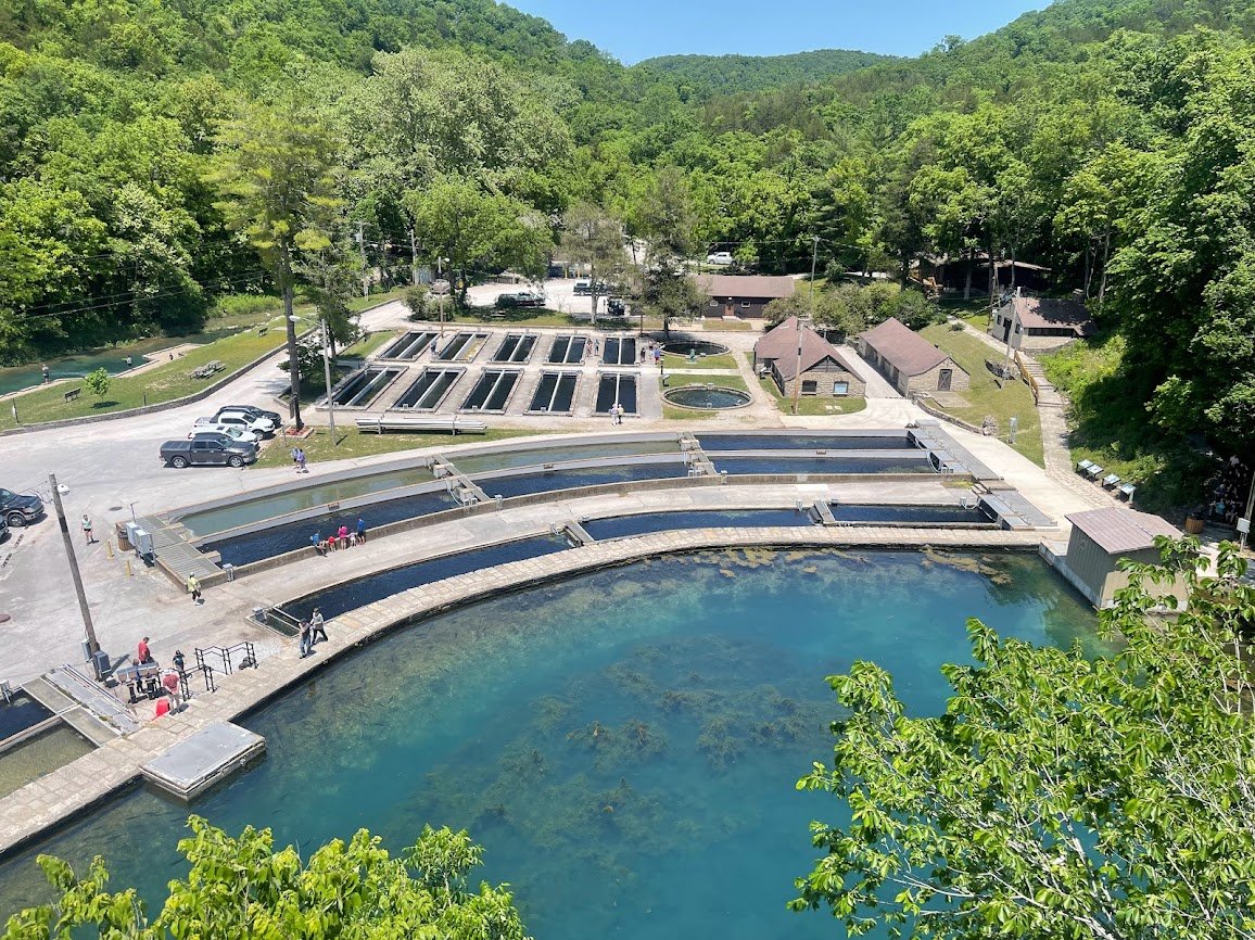
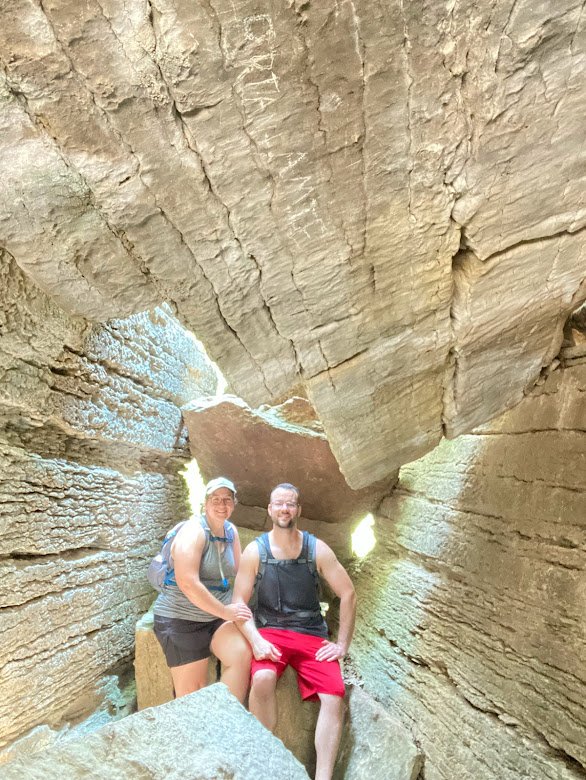
Thanks to the couple that took our photo! Sorry we forgot your names.
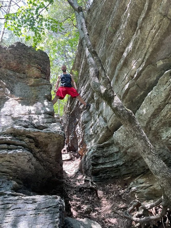
Devil’s Kitchen owes its popularity to its endless caves and giant boulders you can freeclimb. Checking in at only 1.5 miles, it actually took us longer to hike Devil’s Kitchen than it took us to trek the Fire Tower Trail because of the all the photo ops and rock areas to explore.
While most of the hikers we encountered were going clockwise on the loop, we decided to go the opposite route - partly because I like to be contrarian, and partly because the clockwise route immediately takes you up a brutally steep hill that I knew would kick my wife’s ass with her asthma.
There are some thin, distant views of the river along that first portion of the trail, but if you’re looking for river views, you’ll definitely want the Fire Tower or Eagle’s Nest.
After the first half mile or so you’ll reach a few caves, including one that has a creek running out of it. It was a light trickle while we were there, but another couple we met said that they’ve seen it gushing after a good rain.


Past that first big cave, there’s a steady uphill climb before you’ll reach what I think is a false lead but I turned back before I reached its end. There was a tree down blocking the trail and right at that point there’s a long offshoot from the trail that I jogged for a quarter mile before turning back. It steadily got narrower and more overgrown but I didn’t go to the end so perhaps there’s something there.
After reaching the trail’s peak elevation you’ll turn back downhill and start encountering the bulk of the exciting caves and bluffs. I definitely think it was more rewarding to hike the trail counterclockwise like we did since we got to save the best for last.
The eponymous “devil’s kitchen” is a large room-like area with 30-foot bluffs on two sides and a pile of boulders on the other two sides. There’s a narrow passage into the kitchen, then once you enter there’s another cave-like structure formed by two boulders holding up another. It hasn’t shifted in decades from what I can tell and although there’s risk anytime you enter a cave, I didn’t hesitate to climb in.
Supposedly Civil War guerillas held out in the kitchen at one point, though this may be local legend more than documented history. While I didn’t see any union or rebel soldiers, I did see a pair of black vultures perched on a crag just 20 feet away. That was a trip!
There are three more trails at Roaring River State Park that we didn’t end up hiking on this trip.
The 1.1-mile Pibern Trail was constructed in the 1930s by the CCC and runs along the west side of Highway 112.
The 0.6-mile River Trail was another CCC endeavor that runs a more direct route from Campground 2 to the hatchery along the east side of the river.
Finally, the Springhouse Trail checks in at only 0.4 miles and also runs a loop along the west side of Highway 112. Hopefully we can get to all of these on our next visit, as well as a few more trails in the area outside the park.

Me with my friends Jon and Joe in 2010.
Beebe’s Roaring River Water Slide
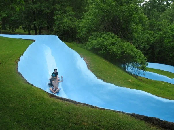
We cut our hiking short on Sunday to visit Beebe’s Roaring River Water Slide in Cassville.
Checking in at over 300 feet long, Beebe’s water slide is a late 1970s fiberglass and concrete slide cut into the side of a steep hill. I’m not sure if Jerry Don Beebe is the original owner of the slide, but I know he’s operated it for longer than I’ve been alive and I hope to interview him some day. He can usually be spotted somewhere in a park wearing a straw hat.

The water slide snakes its way down the hill with three turns before ejecting you at warp speeds into a three-foot pool at the bottom - though it felt like eight feet as a child.
I’ve been fortunate enough to visit Beebe’s at every stage of my life and on many occasions as a young kid. It’s one of those magic places like Roaring River as a whole that just sticks with you and delivers a smile every time you think of it.
For only $10/hour (cash only) you get a rubber mat and a lifetime of memories.
Always pick the small mats, you want as little contact as possible with the ground if you want to go fast. The trick is to put just your butt on the mat and lean back with your legs forward but elevated. It’s an ab workout but you’ll improve your aerodynamics and reduce your drag. Use your hands to hold up the edges of the mat too.
Forming a train with my friends Jon and Joe.
In my dozens of visits to Beebe’s I’ve perfected the process so I can out-speed anybody there. We took my nephew Ty with us this last time and I would let him get a third of the way down the slide before taking off after him and caught up every time.
One of my favorite traditions at Beebe’s is forming a train, where several people grab the tails of each others’ mats and link up. Between your weight and the water pressure building up behind you, you go way faster with a train. But then you also have to dodge the folks in the back of it when you get to the pool at the bottom.

The faster you go, the more you get slammed into the sides of the chute, especially at the last bend before the pool. I’ve hit it so hard and high that I thought I was going to go over it but so far I never have. It’s definitely a slide you can get good and banged up on, but it’s a good kind of painful - especially when you’re an indestructible kiddo.
On this most recent trip I came up with a new game - seeing how many times you can do a 360-degree spin before reaching the bottom. 11 was my record if anyone wants to try and beat it.
Once you reach the pool at the bottom it’s a steep uphill climb to the top - no stairs, just a long concrete path straight uphill with an ancient rail to support you. Unfortunately, the hill kicked Charity’s assthma (pun intended) even harder than the hiking trails did and she had to call it quits after a handful of rides.
For parents there’s a few different seating areas with picnic tables towards the middle of the hill, as well as a shaded grassy area at the top where a lot of folks sit in lawn chairs or on blankets.
Cassville’s River Birch Prairie project at South Park.
There’s also a snack bar with ice cream, smoothies, shaved ice, hot dogs, chicken sandwiches, chicken strips, and more.
All-in-all, even if you don’t like camping or hiking or fishing, Beebe’s Water Slide alone is worth the trip to Cassville.
Cassville Disc Golf
After leaving Beebe’s we met up with my brother and sister in law to play a round of disc golf at the River Birch Prairie disc golf course in Cassville’s South Park. I hadn’t been to this course yet, but it’s a favorite of my brother’s and I soon saw why.
Located at Cassville’s South Park, the disc golf course plays around the River Birch Prairie - a four acre field that was once fescue grass but has been reseeded with native grasses and wildflowers, creating a beautiful pollinator habitat and scenic backdrop for your round.
The course itself is nothing special - an 18-hole Par 57, checking in at around 4439 feet. There are few truly challenging holes. Only three are over 300 feet and those are all par 4s. But while the layout is your typical small-town novice-level course, the view sets it apart in the spring and summer months.
A Scenic Drive

On our way out of town Monday morning, Charity and I decided to detour on the Sugar Camp National Forest Scenic Bypass, but we weren’t too impressed.
There were only a couple of spots where you could pull off at a view point, but I think we might have missed some. There are lots of intersecting rural roads and perhaps there were notable stopping points on those. Next time we’ll do our due diligence ahead of time and make sure we’re following the right path. Just looking at Google Maps I already see we missed a fire watchtower and at least one trailhead.
But, unfortunately, our time was done. The bypass looped us back to Roaring River so we stopped briefly at campground 3 and said our goodbyes to the river and its fresh stream of memories.
Heraclitus supposedly said “no man ever steps in the same river twice, for it’s not the same river and he’s not the same man,” but I have to disagree. When I step foot in Roaring River, I’m transported back in time. The river seems unchanged and I’m still the same kid that used to ride up and down campground 3 on a razor scooter with a coonskin hat and a wooden sword. A part of me will always live on in those waters.